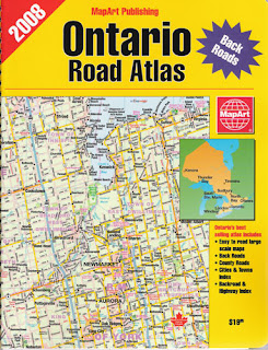
ISBN 978-1-55198-226-7 Retail: $19.95
The best selling Road Atlas of Ontario is back and completely updated for 2008! Scale: 1:250,000
- Easy to Read Large Scale Maps
- Back Roads
- Country Roads
- Cities and Towns Index
- Backroad & Highway Index
This 8.5" by 11" Road Atlas of Canada is
on the best values going! Completely updated:
- Detailed Mapping of Canada's 10 provinces and 3 territories
- 112 pages
- Area maps of all major cities
ISBN 978-1-55368-389-6 Retail: $15.95
The Kitchener and Area Guide is a spiral bound book with street mapping for Ayr, Baden, Blair, Bloomingdale, Brant, Brantford, Breslau, Bridgeport, Cambridge, Conestogo, Doon, Elmira, Elora, Erin, Fergus, Galt, Guelph, Hespeler, Kitchener, Mannheim, New Hamburg, Paris, Preston, Rockwood, St. Jacobs, Salem, Waterloo and Regional Roads for the Area.
Also includes Points of Interest and a listing for Oktoberfest Halls in the Kitchener Area. 90 Pages. Scale - 1:25,000
All available now at your favourite retailer or at MapArt.com


